A new study by researchers from the U.S. Forest Service and the University of Delaware has revealed how dissolved inorganic carbon (DIC) and total alkalinity (Alk T) are transported and transformed by rivers and glaciers in western Canada and southeast Alaska before reaching the Gulf of Alaska.
The study, published in the Journal of Geophysical Research: Biogeosciences, provides a comprehensive assessment of the freshwater and carbon fluxes from one of the most geographically diverse but understudied regions on the planet.
Why DIC and Alk T Matter
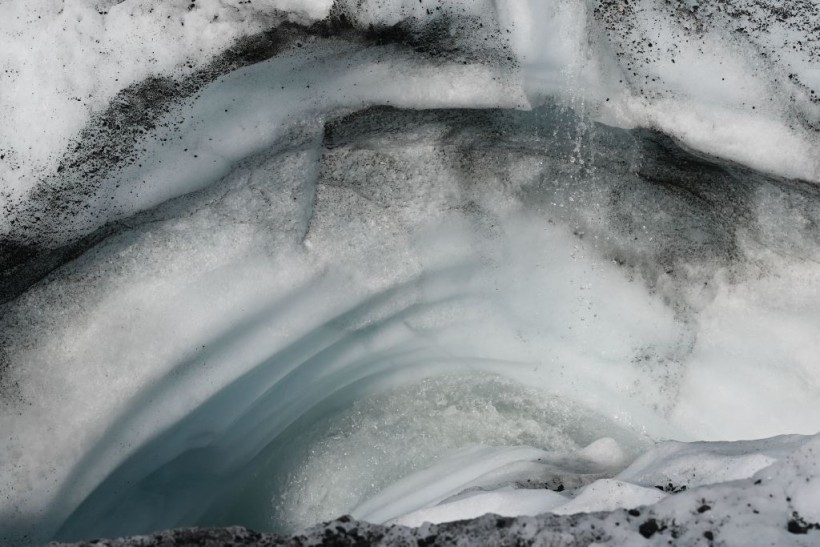
 (Photo : PATRICK T. FALLON/AFP via Getty Images)

DIC and Alk T are important indicators of the carbon cycle, which describes how carbon is exchanged among the atmosphere, land, and ocean.
DIC is the sum of carbon dioxide (CO2), bicarbonate (HCO3-), and carbonate (CO32-) in water, and Alk T is the measure of the water's ability to neutralize acids.
Both DIC and Alk T affect the pH and carbonate saturation state of seawater, which in turn influence the rates of primary production, coral reef formation, coastal ocean acidification, and continental shelf ecology.
The sources and sinks of DIC and Alk T in coastal zones are complex and variable, depending on the interactions among terrestrial, marine, and atmospheric processes.
For example, DIC and Alk T can be produced by the decomposition of organic matter, weathering of rocks and minerals, and dissolution of carbonate shells and skeletons.
They can also be consumed by photosynthesis, calcification, and burial of sediments.
Additionally, DIC and Alk T can be exchanged with the atmosphere through gas exchange and with the ocean through mixing and advection.
How the Study Was Conducted
The study region covers an area of about 1.3 million square kilometers, spanning from northern British Columbia to the southwestern corner of the Yukon Territory.
The region is characterized by a wide range of land cover types, including glaciers, forests, mountains, and plateaus, and a complex network of rivers that drain into bays, fjords, and channels before reaching the Pacific Ocean.
The region also experiences large seasonal and spatial variations in precipitation, temperature, and runoff.
To estimate the freshwater and carbon fluxes from the region, the researchers combined a digital elevation model with estimated shapes of watershed boundaries and glacier extents, as well as gridded data representing mean monthly runoff.
They used a distributed climate water balance model calibrated with measurements taken from watersheds in the study area to calculate the total amount of freshwater runoff.
They also used empirical relationships between runoff and DIC and Alk T concentrations to estimate the carbon fluxes from each watershed.
The researchers validated their model results by comparing them with available observations of freshwater discharge, DIC, and Alk T from several rivers and estuaries in the region.
They also analyzed the spatial and temporal patterns of DIC and Alk T production and export, and the factors that control them, such as watershed type, location, and flow rate.
What the Study Found
The study found that the region exports about 430 cubic kilometers of fresh water and 1.17 teragrams of DIC annually to the Gulf of Alaska, which account for about 8% and 6% of the total freshwater and carbon inputs to the North Pacific Ocean, respectively.
The study also found that the region exports about 0.34 teragrams of Alk T annually, which is equivalent to about 2% of the total Alk T input to the North Pacific Ocean.
The study revealed that the freshwater and carbon fluxes vary significantly across the region, depending on the watershed characteristics and hydrological conditions.
For instance, the researchers found that glaciers contribute about 40% of the freshwater runoff, but only 10% of the DIC and Alk T fluxes, because of their low carbon content and dilution effect.
On the other hand, they found that forested watersheds contribute about 30% of the freshwater runoff, but 50% of the DIC and Alk T fluxes, because of their high carbon content and production rates.
The study also showed that the freshwater and carbon fluxes vary seasonally, with the highest values occurring during the summer and fall months, when the precipitation, temperature, and runoff are high.
The researchers estimated that about 70% of the annual freshwater and carbon fluxes occur between June and October, with peak values in August and September.
The study highlighted the importance of considering the spatial and temporal variability of freshwater and carbon fluxes in coastal zones, and the need for more data and monitoring to improve the understanding and modeling of these fluxes.
Freshwater and carbon fluxes from the region may change in the future, due to the effects of climate change and human activities on the hydrology and carbon cycle of the region.
The region is a significant source of freshwater and carbon to the Gulf of Alaska, and that the rivers and glaciers in the region play an active role in transforming and transporting DIC and Alk T from land to sea.
It is a valuable natural resource and a hotspot of biodiversity, and that its conservation and management are essential for the sustainability of the ecosystem and the well-being of the people.
Related article: Powerful Autumn Storm to Barrel Towards Alaska in the Coming Days [NWS]
© 2024 NatureWorldNews.com All rights reserved. Do not reproduce without permission.


