Tropical forests are home to some of the most diverse and unique mammal communities on Earth, but they are also under threat from deforestation, climate change, and human activities.
To conserve these ecosystems and their wildlife, researchers need to understand how different habitats affect animal diversity and behavior.
However, traditional methods of measuring habitat characteristics are time-consuming, labor-intensive, and often inaccurate.
For example, researchers may use tape measures, rulers, or calipers to estimate the height, width, and depth of vegetation on the forest floor, which can vary greatly depending on the observer's perspective and skill.
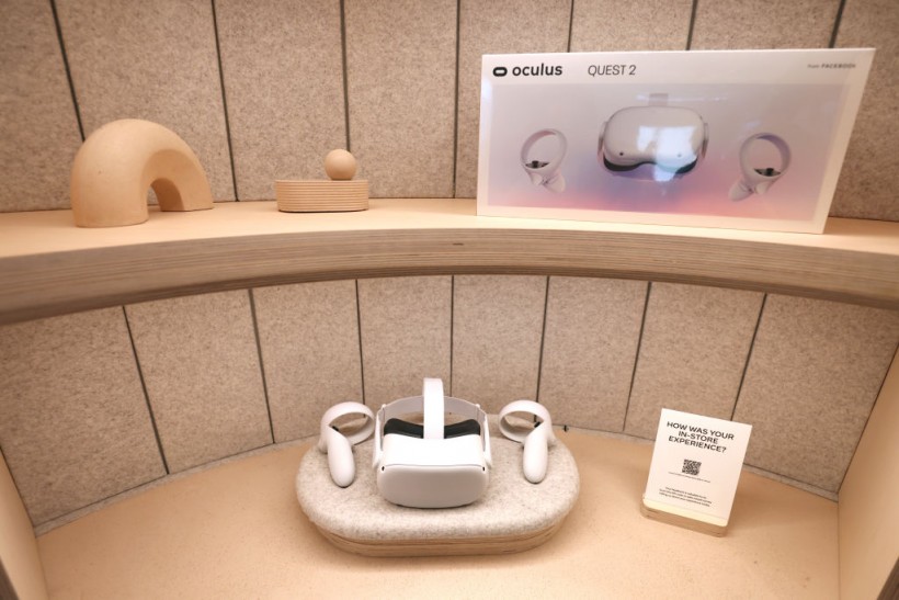
To overcome these challenges, a team of scientists from Rice University, the Udzungwa Ecological Monitoring Center, and the University of Florence have developed a novel approach that uses a commercially available mixed-reality headset with custom-designed software to measure and analyze forest floor vegetation.
A new way to measure habitat diversity
 (Photo : Justin Sullivan/Getty Images)

The device, called Microsoft HoloLens, projects a 3D mesh over the real-world environment, allowing the user to see both the virtual overlay and the surrounding scenery.
The software, called VegSense, allows the user to record data about the vegetation they see as they walk through a field site and create downloadable files for later analysis.
VegSense can measure the shape and configuration of the forest floor vegetation, such as its surface area, volume, complexity, and roughness.
These metrics can then be used to quantify the habitat diversity and quality for different animal species.
Also Read: World's Forest Are Getting 'Weaker' Due To Unstable Conditions Caused by Human Interactions
A link between habitat structure and mammal diversity
The researchers tested their method in Tanzania's Udzungwa Mountains National Park, a biodiversity hotspot that hosts more than 70 mammal species, including elephants, monkeys, antelopes, and carnivores.
They collected paired data from 31 points within the protected forest using both VegSense and motion-activated trail cameras that capture images of passing animals.
They then used a statistical model to assess the relationship between the habitat structure measured by VegSense and the mammal diversity recorded by the cameras.
According to the study, mammal diversity increased with forest floor habitat surface area, meaning that locations with more complex and varied vegetation had more species and more ecological variety.
Moreover, VegSense was faster, easier, and more accurate than traditional methods of measuring habitat structure.
They estimated that using VegSense reduced the time required to collect data by 75% and increased the accuracy by 25%.
Furthermore, VegSense was able to capture features that were not visible or measurable by human observers, such as small gaps or crevices in the vegetation.
The researchers hoped that their method will help other scientists and conservationists to monitor and protect tropical forests and their wildlife.
They also plan to improve VegSense by adding more features and functions, such as automatic identification of plant species and estimation of biomass. They believe that VegSense can be applied to other ecosystems and research questions as well.
"VegSense is a powerful tool that can revolutionize how we study habitats and their effects on wildlife," said Daniel Gorczynski, a postdoctoral researcher at Rice University and the lead author of the study.
"By using mixed-reality technology, we can measure habitats in ways that were not possible before and gain new insights into how animals interact with their environment," he added.
Related article: Boreal Forests and Climate: 3 Trillion Trees in World
© 2024 NatureWorldNews.com All rights reserved. Do not reproduce without permission.

![Climate Change is Reducing Dust Levels Worldwide as Arctic Temperature Warms [Study]](https://1471793142.rsc.cdn77.org/data/thumbs/full/70320/280/157/50/40/climate-change-is-reducing-dust-levels-worldwide-as-arctic-temperature-warms-study.jpg)
![Tsunami Hazard Zones: New US Map Shows Places at Risk of Flooding and Tsunamis Amid Rising Sea Levels [NOAA]](https://1471793142.rsc.cdn77.org/data/thumbs/full/70325/280/157/50/40/tsunami-hazard-zones-new-us-map-shows-places-at-risk-of-flooding-and-tsunamis-amid-rising-sea-levels-noaa.jpg)


