A National Weather Service (NWS) report shows that snowy and cooler conditions are likely in the Northwestern US this week. Potential snow can occur in higher-elevation areas.
Recently, low-elevation rain was recorded in the Northern Rockies and Northwest. People with travel plans should consider the latest forecasts, causing slower commutes in the region.
Additionally, the forecast monitors the development of an upper level in the East and Northwest, helping to bring potential cooler weather. Meanwhile, summer-like warmth can spread over the Midwest to the Mid-Atlantic.
Meanwhile, above-average temperatures can unload in the central and eastern U.S. Critical fire weather concerns can unload in the Southern High Plains.
Northwestern US Weather Forecast This Week

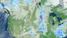
(Photo : Zoom Earth Satellite via NESDIS - NOAA)
The latest weather report shows that below-average temperatures are expected in the Northwest, with snow potential in the Northern Rockies through Friday. From eastern New Mexico to southeast Colorado, Red Flag Warnings are present.
NWS San Diego monitors a system in the region that could bring moisture potential and light rains. The incoming system can unleash onshore winds from the west, which could increase this weekend. Gusty winds could exceed 30 mph and 40 mph.
A recent advisory in Salt Lake City revealed potential freeze conditions on Wednesday night and Thursday morning. The forecast warns that it could damage crops and vegetation.
Furthermore, the NWS Bay Area monitors the development of a cold front, which could bring potential light to moderate rain, especially in the North Bay and Santa Cruz Mountains. Commuters should allow extra time to travel, including increasing distance from other vehicles.
On Thursday, Reno residents can expect warm weather with afternoon breezes. However, homeowners should be alert for sharply colder weather, with a chance of gusty winds and high-elevation snow.
From Friday to Saturday, a large storm may bring cooler and falling snow levels. The rounds of rain are forecast in the following areas:
- Seattle
- Portland
- Bend
- Medford
- Redding
- San Francisco
- Fresno
Parts of California, including San Francisco and Sacramento, can experience rounds of rain. Slick and slippery roads will likely challenge motorists' commutes.
From the weekend to Monday, strong wind potential is likely in Las Vegas, Phoenix, and Grand Junction. In Chicago, residents can experience above-average temperatures in northern and central Illinois and northwest Indiana. Potential precipitation can occur on the south of Interstate 80.
The latest advisory for Baltimore-Washington shows that dry conditions and seasonable temperatures are expected this week. Outdoor enthusiasts can experience plenty of sunshine and high temperatures that are favorable for outdoor travel.
On the weekend, rain and thunderstorms can occur in Seattle and Portland.
Also Read: US Latest Severe Weather Forecast: Tornado, Stormy Conditions Likely Next Week
Road dangers: How can commuters stay safe this week?
The latest weather report shows that a snowy outlook and precipitation potential are likely in Northwestern US. Motorists should check for the road conditions before traveling, particularly in snow-covered areas.
When daily commutes are not essential, homeowners can stay at home until the weather improves. Additionally, checking the condition of the vehicle is the best step to ensure safety.
Related Article: East Coast Weather Forecast: Unsettled Conditions to Bring Thunderstorms, Showers This Week
For more similar stories, don't forget to follow Nature World News.
© 2024 NatureWorldNews.com All rights reserved. Do not reproduce without permission.